
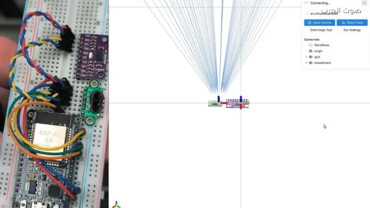
A developer has created a system capable of scanning rooms and generating real-time 3D maps using readily available and affordable technology. The experimental setup, developed by Enrique Ferreiro, utilizes an ESP32 microcontroller alongside sensors including a VL53L5CX and an Inertial Measurement Unit (IMU).
How the Novel System Works
The system relies on the VL53L5CX sensor, a compact device functioning as an 8×8 point measurement array. It measures distances up to 4 meters using Time-of-Flight technology, which calculates the time it takes for light to reflect off surfaces within the room. This makes the system highly effective at accurately determining distances.
Data Integration
The system combines distance data from the sensor with motion data from the IMU, which provides information about the device’s tilt and rotation as it’s moved through the room. The ESP32 microcontroller merges this data in near real-time, then transmits it as structured data via wireless connection to a computer. There, it’s displayed as a 3D map representing the room’s components.
Display Software
Ferreiro developed a 3D display program in Python that runs on the computer. This program receives data from the ESP32 and reconstructs the shape of the room for the user, showing walls and furniture as points distributed in space. The source code for both the program and the ESP32 software is available on GitHub, allowing hobbyists and researchers to replicate the project or adapt it for other applications.
Sensor Capabilities
ST offers a range of Time-of-Flight sensors, including simpler models like the VL53L0X, which functions as a single-distance sensor up to 2 meters. However, the VL53L0X doesn’t provide the multi-zone measurement grid of the VL53L5CX. The latter can measure the distance for each point in an 8×8 grid at a sampling rate of up to 60 readings per second, making it more suitable for fast 3D scanning applications.
Future Potential
The project demonstrates how commercially available, affordable components – such as the ESP32, sensors, and IMUs – can deliver functionality previously requiring expensive, professional equipment, like room scanning and 3D map creation. This type of open-source project paves the way for the use of 3D scanning technologies in a variety of fields, including educational robotics, smart home applications, and simple augmented reality experiences. It could too potentially expand into architectural space modeling in the future. The accessibility of this technology could broaden the use of spatial mapping for a variety of applications.