A three-day period of unstable weather is forecast for the Brazilian state of Rio Grande do Sul, with the highest risk of severe storms expected on Saturday, March 21, and Monday, March 23, as a cold front advances with an atmospheric low-pressure center.
Currently, Rio Grande do Sul is experiencing a heat wave with temperatures well above average for this time of year. The shift in weather patterns comes as autumn officially begins in the region.
On Friday, March 20, temperatures reached 38.6°C (101.5°F) in Porto Xavier; 38.5°C (101.3°F) in Santa Rosa; 37.4°C (99.3°F) in Doutor Maurício Cardoso; 36.9°C (98.4°F) in Garruchos; 36.8°C (98.2°F) in Porto Vera Cruz, São Borja, and Santo Ângelo; 36.7°C (98.1°F) in Boa Vista das Missões and Santo Antônio das Missões; 36.6°C (97.9°F) in Alpestre; 36.4°C (97.5°F) in São Luiz Gonzaga; 36.1°C (97°F) in Taquari; 36.0°C (96.8°F) in Maçambará and Ijuí.
The weather is expected to change across much of Rio Grande do Sul on Saturday, March 21. While the sun will be visible through clouds, cloud cover will increase throughout the day. Rain will initiate in western and southern areas, spreading to most cities in the state by the end of the day.
With high temperatures persisting, there is a risk of localized heavy rainfall and isolated thunderstorms during the latter part of Saturday. The heat will remain strong, though less intense in the western part of the state, but will strengthen in the Greater Porto Alegre area, valleys, Serra, and North Coast, with temperatures exceeding 35°C (95°F) in some regions.
The unstable weather will continue throughout most of Sunday, March 22, with increased cloud cover and periods of sunshine. Showers are expected in various regions, potentially beginning overnight or in the morning. Isolated heavy rainfall is possible. The increased cloud cover and instability will limit temperature increases, reducing the risk of severe weather.
However, instability is forecast to increase significantly on Monday, March 23, with the arrival of the cold front and the influence of a low-pressure system. This will bring intense rainfall to parts of the state and further elevate the probability of severe weather.
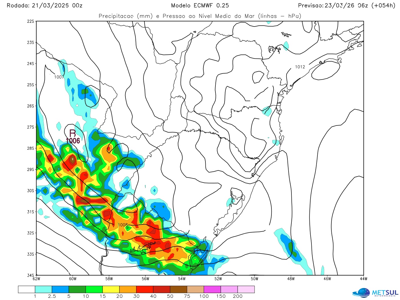
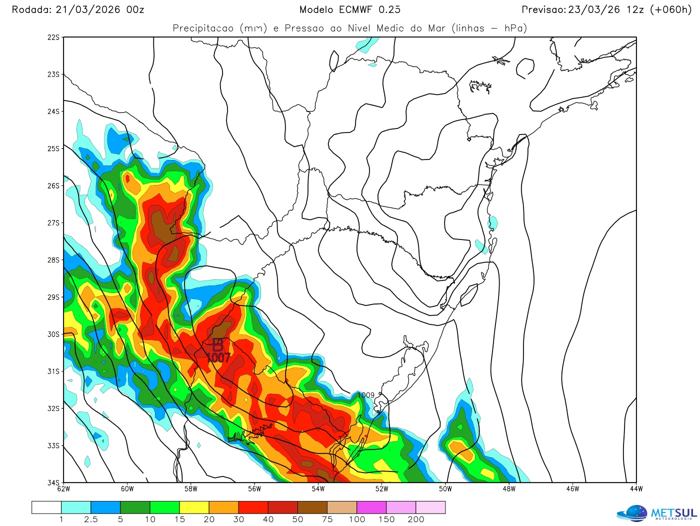
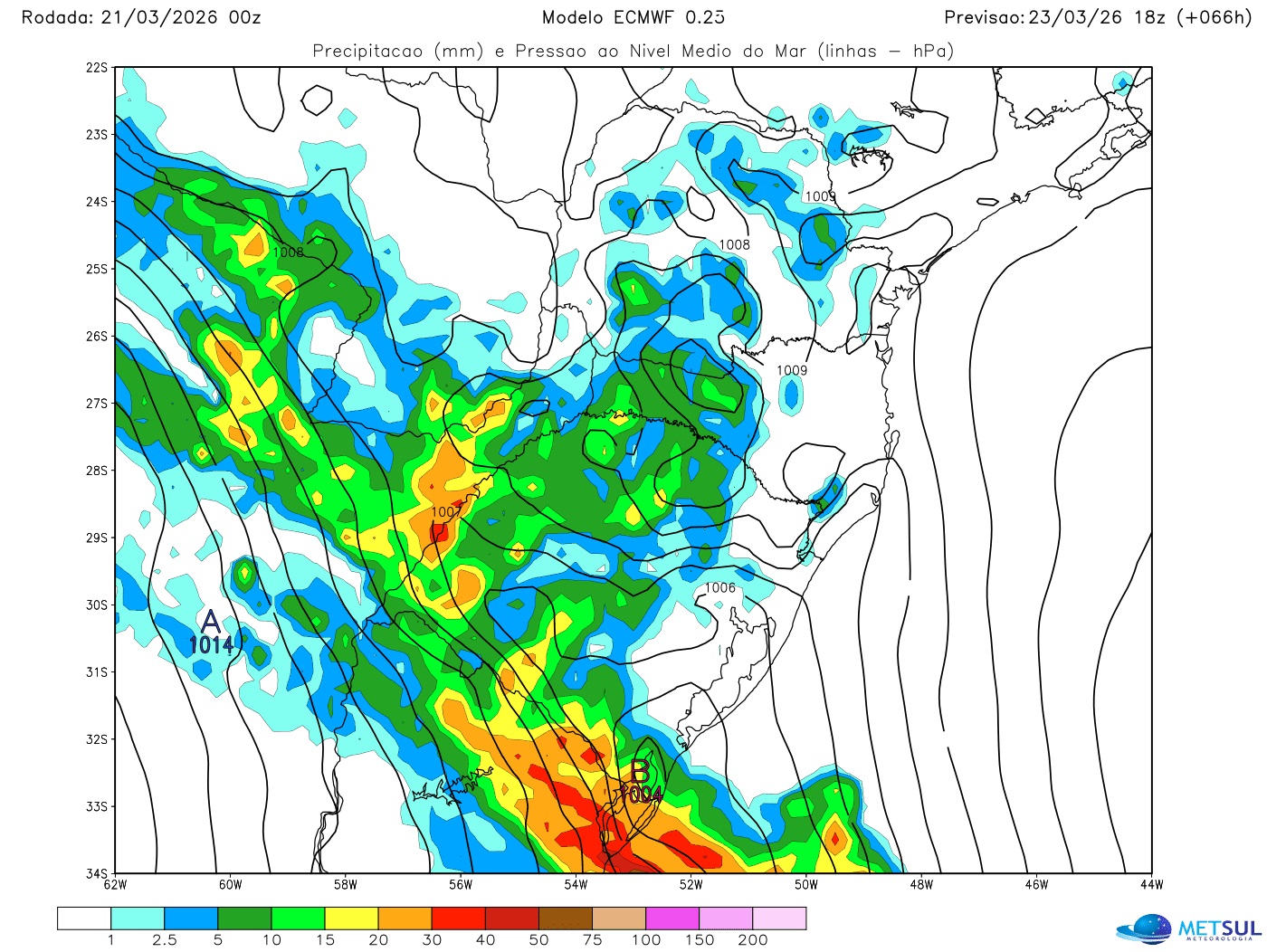
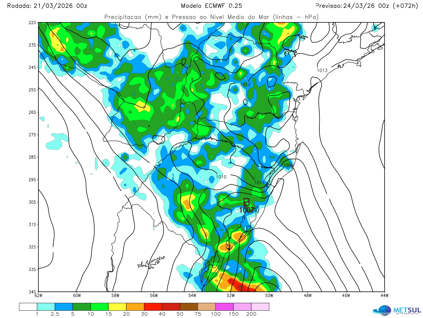
The following maps show projected precipitation and surface atmospheric pressure every six hours from the early morning to night on Monday, using data from the European Centre for Medium-Range Weather Forecasts (ECMWF).
METSUL
METSUL
METSUL
METSUL
The maps illustrate how instability will dramatically increase overnight and during the morning of Monday over Uruguay and western and southern Rio Grande do Sul, particularly in border areas.
The risk of heavy to intense rainfall with high volumes in a short period, along with the possibility of thunderstorms, some strong to isolated severe, will be high.
Elsewhere in Rio Grande do Sul, the sun will appear with clouds on Monday and it will be very hot. However, as the cold front and low-pressure system move through in the afternoon and evening, the atmosphere will become unstable with rain. Given the very high temperatures, there is a risk of isolated heavy rainfall, and thunderstorms.
The front’s movement on Monday is expected to destabilize the weather in parts of Santa Catarina and Paraná as well, with a risk of localized heavy rainfall and isolated thunderstorms due to the very warm atmosphere.
The isolated thunderstorms between Saturday, March 21, and Monday, March 23, may cause localized heavy rainfall, occasional hail, and strong wind gusts. The regions of greatest risk in Rio Grande do Sul this weekend are the West, Center, and South.
Anúncios