
สําหรับ
Portugal is bracing for a return to more traditional winter weather, with a shift towards colder temperatures and potential snowfall expected later this week. After a relatively mild start to the season, meteorologists are forecasting a period of increased precipitation and a drop in temperatures, bringing a welcome change for those hoping for a more classic winter experience.
December’s milder conditions are giving way to a pattern more typical of the season, with a potential for polar air to move into the region. While January has been less rainy than November and December, the forecast suggests a change is coming, bringing with it a mix of winter conditions.
Recent forecasts initially indicated a return to wetter conditions, with a strong zonal flow and active fronts. However, predictions have shifted, and the focus is now turning back to colder temperatures and the possibility of snow.
The current trend, combined with atmospheric teleconnections favoring high pressure over the Atlantic and Northern Europe, suggests a week of occasional rain, followed by a significant temperature drop in the latter half of the week. While a named storm remains a possibility between Thursday and Friday, current models don’t strongly support that scenario.
Those hoping for a dry weekend, particularly on January 17-18, may be in luck, especially in mainland Portugal. However, the threat of colder weather persists.
The Azores and Madeira are expected to experience more stable conditions, with the high-pressure system in the Atlantic keeping rainfall to a minimum. However, the Azores could see some occasional precipitation early in the week, with a yellow warning already issued by IPMA due to intense rainfall.
While these are isolated incidents, the overall trend points to stability. The Azores will experience little wind, especially in the latter half of the week, while Madeira is forecast to see stronger winds, potentially with strong gusts from the northwest, and colder temperatures starting Friday.

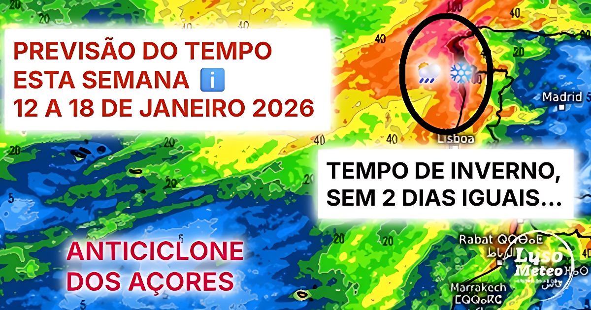
WEATHER FORECAST THIS WEEK, JANUARY 12 TO 18, 2026
Before we move on to the forecast, we would like to thank our sponsor – Jardinagem Coelho – specialists in gardening services, garden construction and renovation, and the sale and installation of synthetic and natural turf in Marinha Grande! Contact information is in the image!

MAINLAND PORTUGAL
For Monday, mainland Portugal can expect very cloudy skies with clearings inland and further south, strong winds along the coast and highlands, and precipitation along the coast, spreading across the entire territory later in the day. Strong waves are expected, along with rising temperatures.
On Tuesday, precipitation will extend across the entire territory overnight, transitioning to showers in the morning, generally moderate, and occasionally accompanied by thunderstorms. The wind will remain strong but is expected to decrease in the afternoon, with temperatures falling and a forecast of snow at the highest points of Serra da Estrela.
Wednesday is expected to be drier, but not particularly sunny. Skies will be cloudy in most regions, with fog and mist in the morning, potentially giving way to some sunshine in certain areas in the afternoon. However, the threat of clouds will remain. No rain is expected, and it will be slightly colder at night, with the possible formation of frost in sheltered inland areas.
While temperatures will dip slightly on Wednesday, they are expected to fall significantly on Thursday, with values potentially reaching 0°C and even lower in sheltered areas – frost and ice are predicted. However, precipitation will also arrive on Thursday morning, affecting the entire country and accompanied by strong winds. Snow may fall at the highest points of Serra da Estrela (uncertain!). The sea will become agitated again.

The discomfort will be evident these days, with a north wind rotating to northwest, causing a low wind chill. Friday will see showers, and snow will return at slightly lower altitudes – potentially around 1200 meters, or even lower further north – likely resulting in heavy snowfall in the mountains!
The weekend is uncertain, with Saturday having a high probability of precipitation according to ensembles (EPS and GEFS), but it’s not conclusive. Therefore, “anything can happen,” but at least along the coast, it’s advisable to have an umbrella ready.
Sunday, on the other hand, shows a slight decrease in the probability of precipitation, with a trend towards colder weather and the approach of the Azores High. It could be a dry and cold day, perhaps with sunshine, given the flow pattern. This could also signal a shift this month, but it’s something to monitor – see the information at the end of this publication for a first look!

AZORES
If you live in the Azores, expect a more stable week, with more precipitation and stronger winds in the first half. However, nothing too significant is anticipated.
For Monday, occasional showers are likely, nothing major, with some strong northwest winds mixed in, leading to falling temperatures.
Tuesday will see a weakening of the wind, becoming much lighter, and a rotation, especially in the Western Islands – to the Southwest, signaling the approach of a frontal system, which could effectively arrive on Wednesday. Rain is expected in the Western Island group in the early morning and afternoon, likely spreading to the Central group. No rain is currently forecast for the Eastern Islands.
On Thursday, briefly, in the early morning and afternoon, the rain could extend to the Eastern Islands, but quickly disappear in the afternoon, with increasing anticyclonic influence. This could be the dominant atmospheric state for the rest of the week, predicting clear skies and a low probability of precipitation.
It’s important to note that forecasts for the archipelago are always complex due to their location and the limits of high and low pressure. Small changes can lead to significant alterations, so we suggest following our daily forecasts to stay updated.

MADEIRA
Precipitation forecast for Madeira this week is also not significant, which is not new, given the pattern of occasional bad weather days followed by days of stability, sometimes with wind.
For Monday, a front is expected to pass at the end of the day, bringing intense precipitation and wind, which should continue into Tuesday in the form of showers.
However, from Wednesday, stability will dominate, with a mix of clouds and clear skies, as has been typical. Initially, there will be little wind between Wednesday and Thursday, first from the Northeast on Wednesday and then from the Northwest on Thursday. These variations in wind intensity will translate into changes in the perceived temperature, although the temperature itself will not change much.
Thursday may see the approach of a front, but it’s transient and could bring light precipitation. However, this is not yet conclusive and could mark the turning point for the weekend. Expect a windy weekend.
Therefore, between Friday and especially on the weekend, the wind is expected to blow strongly, generally from the North, sometimes with significant gusts, and the temperature should drop. Any showers that do occur could be snow at higher points on the island. Be aware of the possibility of disruptions to air traffic at Madeira Airport.

COLDER WEATHER EXPECTED NEXT WEEK?
The evolution of weather forecasts for the rest of January is proving challenging for meteorologists, with much uncertainty regarding dominant atmospheric patterns in the Atlantic. While the high-pressure system appears robust, it is also quite mobile, and a blocking pattern in Scandinavia could easily emerge, facilitated by the transition of the MJO through phases 6/7/8, among other factors.
If this blocking pattern emerges, after days 22/23, the active Atlantic depressions will tend to descend towards Central Europe, forming pockets of cold air that could repeat the beginning of January – colder temperatures and more snowfall. What this means for Portugal depends on many factors!
If the Atlantic has a more zonal, more active flow, the trend will be towards occasional precipitation, especially in the North, accompanied by some cold and snowfall. If, on the other hand, the jet stream breaks more (a more likely probability), the trend will be towards colder weather, but less precipitation.
However, it is these blocking situations and cold air installed in the interior of the European continent that can truly bring more “serious” winter episodes, and that could bring snowfalls at less common altitudes this year, which is more reminiscent of winters of the past. Nothing concrete is predicted, only probabilities, in a month that is expected to be less rainy than previous ones, but with a lot of variability.
Continue to follow our weekly forecasts – the next one, with more details for the last week of the month, will be released on the 18th, stay tuned! Thank you very much for reading this forecast, which we hope will be very useful!

Despite being very humid, January so far has been more marked by cold – which continues to emerge significantly. Long-term forecasts are reducing precipitation, and increasing uncertainty for the end of the month – do you miss consecutive days of sunshine? I confess I do! Leave your opinion in the comments below!
If you found this article in your Google News/Discover feed, click follow/like (on the ❤️ symbol) to see more of our forecasts and information and don’t miss anything! Also follow the Luso Meteo – Meteorology and Climate page on our social networks and on Google News HERE for more updates and information!
If you would like to help with donations to the project, to support website/maintenance costs and subscription services to bring you the best content, you can do so, we would be very grateful!, by MBWay to 918260961, or IBAN to PT50 0007 0000 0029 3216 7422 3
Thank you very much for your trust and preference ❤️
Special thanks to WebDig, our website hosting service – highly recommended, with incredible reliability and support!