Historic Super Typhoon Dolphin hits Category 5 strength in the Northwest Pacific
Super Typhoon Dolphin has intensified to Category 5 strength, packing 160 mph winds as it tracks toward the Ogasawara Islands and Japanese waters.
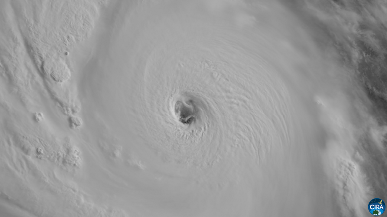
📍 The outcome
{ "epilogue": "Super Typhoon Dolphin reached Category 5 strength with 160 mph winds while barrelling toward Asia and tracking near Wake Island, the Ogasawara Islands, and Japan's Minami-Torishima Island. The storm was forecasted to bring very hot weather to Hong Kong and posed congestion risks to Chinese ports.
Epilogue added 44d ago, after coverage quieted.
Momentum
How fast coverage is spreading — measured hourly from article rate × source diversity. How this works →
The story so far
Sustained winds of 160 mph now define Super Typhoon Dolphin, a storm that has reached the equivalent intensity of a Category 5 hurricane in the Northwest Pacific. Projections from Yale Climate Connections and FOX Weather indicate the system could potentially reach 180 mph by Friday. The storm previously tracked near Wake Island and is currently moving westward.
International outlets including The Japan News and News On Japan report the system is heading toward Minami-Torishima and the Ogasawara Islands. Beyond the immediate threat to these islands, IndexBox notes that Chinese ports are bracing for potential logistics congestion, citing recovery efforts still underway following Typhoon Bavi. The storm remains a significant maritime concern as it barrels toward the Asian coast.
Tracking data places the storm near Minami-Torishima by Sunday. While meteorologists monitor the trajectory toward western Japan, precise impacts on mainland infrastructure depend on the typhoon's future path and velocity. The Guam Daily Post and other sources continue to update wind speed estimates as the system progresses.
Synthesized by headlinez.news from the headlines below under a strict no-invention contract. ✓ fact-checked: all claims supported by sources Updated 47d ago.
Who reported it (11)
- Super Typhoon 12W (Dolphin), # 13 stripes.com · 47d ago
- Satellite Shows 'Mesmerizing and Swirling' Eye of Super Typhoon Dolphin Yahoo · 47d ago
- Super Typhoon Dolphin set to bring very hot weather to Hong Kong next week South China Morning Post · 47d ago
- Typhoon Dolphin Forecast to Reach Sea Near Japan’s Minami-Torishima Island by Sunday The Japan News · 47d ago
- Super Typhoon Dolphin Risks Further Congestion at Chinese Ports Still Recovering from Bavi IndexBox · 47d ago
- Typhoon No. 13 Heads Toward Ogasawara as Western Japan Risk Emerges News On Japan · 47d ago
- Super Typhoon Dolphin barrels towards Asia as it reaches 160 mph winds, equivalent to a Category 5 hurricane FOX Weather · 47d ago
- Typhoon Dolphin eases closing in on Wake Island, may still roar to 180 mph by Friday The Guam Daily Post · 47d ago
- Super Typhoon Dolphin barrels towards Asia as it reaches 160 mph winds, equivalent to a Category 5 hurricane Yahoo · 47d ago
- Typhoon Dolphin to Move Westward toward Japan’s Ogasawara Islands The Japan News · 47d ago
- Historic Super Typhoon Dolphin hits Category 5 strength in the Northwest Pacific Yale Climate Connections · 47d ago
The obvious questions
What is the current intensity of Super Typhoon Dolphin?
The storm has reached Category 5 strength, with winds clocked at 160 mph.
Which areas are in the storm's projected path?
Current forecasts identify Minami-Torishima, the Ogasawara Islands, and portions of western Japan as potential areas of impact.
Are there concerns regarding supply chains?
Yes, IndexBox reports that Chinese ports may face congestion due to the storm, complicating recovery efforts from Typhoon Bavi.
Related visual coverage
Automatically selected only when the subject entities match this story. Embeds remain hosted by their original platforms.
Siêu bão Cá heo lập kỷ lục kinh hoàng: Dị thường chưa từng có, có thể là siêu bão mạnh nhất lịch sử
YouTube · Tiền Phong TV
Topics
From around our network
Related trends
Taiwan representative in Japan boycotts Nagasaki bombing anniversary ceremony over seating
Taiwan's top envoy in Japan boycotted the Nagasaki bombing memorial after organizers placed his delegation outside the diplomatic zone.
Famitsu sales (7/20/26 - 7/26/26) - first week sales revealed for Splatoon Raiders, big Nintendo Switch 2 boost
Splatoon Raiders leads a surge in Japanese physical retail as Nintendo Switch 2 hardware adoption accelerates following its recent market debut.
Hope dwindles for rescue in southwestern Japan quake as death toll climbs to 25
Search and rescue efforts in southwestern Japan are shifting as the confirmed death toll reaches 34 following a major earthquake.
Death toll in Japan earthquake rises to 23 as aftershock and heat complicate rescue efforts
Southwestern Japan faces mounting fatalities and logistical strain as rescue operations contend with extreme heat and aftershocks following a major earthquake.
After the quake came the blast: Inside Japan's shopping mall disaster
An earthquake in Japan’s Kyushu region has resulted in 14 confirmed deaths and widespread industrial disruption.
Japan earthquake: More than 100 aftershocks hit after deadly quake that killed 13
Emergency crews in southwestern Japan are conducting rescue operations following a 7.1 magnitude earthquake that resulted in multiple confirmed fatalities.