

A notable winter storm is impacting Poland, bringing heavy snowfall and hazardous travel conditions to much of the country. Beginning Tuesday evening, substantial accumulations – reaching up to 16 inches in mountainous regions – have already been reported, particularly in Lower Silesia, opole Voivodeship, and Silesia. Numerous weather alerts are currently in effect through Thursday morning as the storm expands, and emergency services are responding to reports of stranded motorists, including a dramatic rescue operation in the Podkarpackie region. Authorities are urging extreme caution as snowfall continues and temperatures remain near freezing.
Heavy snowfall blanketed parts of Poland beginning Tuesday evening and continuing overnight, with some areas of Lower Silesia receiving up to 5.5 inches of snow, according to the Institute of Meteorology and Water Management. Further accumulation is expected Wednesday, particularly during the afternoon.
Snowfall Continues, Numerous Weather Alerts Issued
Much of Lower Silesia, Opole Voivodeship, and Silesia are currently covered in snow, and the conditions are expected to persist with temperatures hovering around freezing. Additional snowfall is forecast throughout the day, gradually expanding the affected area across the country.
SEE: People trapped in vehicles as emergency services respond in Podkarpackie region
Roads and sidewalks are covered in snow, as evidenced by images shared on social media, including by the Storm Watch Network on Facebook:
Snowstorms are expected to impact nearly the entire country Wednesday, stretching from the southwest through central Poland and into the northern regions. First and second-degree warnings for heavy snowfall are in effect for these areas through 4:00 and 6:00 a.m. Thursday, with accumulations potentially reaching 8-10 inches in some locations. The widespread snowfall is creating hazardous travel conditions and prompting authorities to urge caution.
Mountainous regions are forecast to receive the most significant snowfall, with potential accumulations of up to 16 inches.
Snowfall will vary in intensity throughout the day. A brief lull is expected after morning showers, but conditions will deteriorate again around noon. Snowfall will intensify in northern Poland during the evening, particularly in the Warmia and Masuria regions.
SEE: Winter returns with a vengeance: Roads blocked, power outages reported
Wednesday will see overcast skies across most of Poland, with relatively clearer conditions expected in the west and northwest, where precipitation should be minimal.
 WXCHARTS
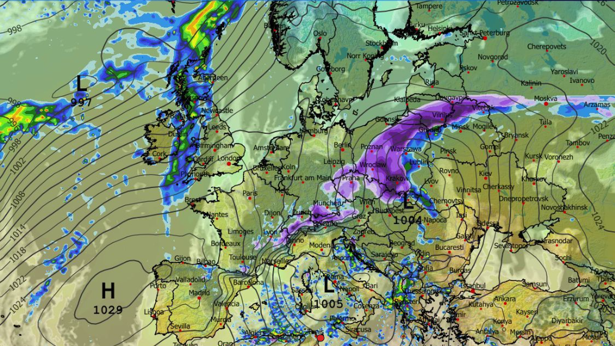
Snow is expected across a band stretching from Lower Silesia, Opole Voivodeship, and parts of Lesser Poland, through Greater Poland, central Poland, and into Warmia and Masuria. Rain is forecast for the southeastern regions, where roads may be slick and visibility reduced, according to Albedo synoptician Kazimierz Walaszek, whose forecasts are used by Polsat News.
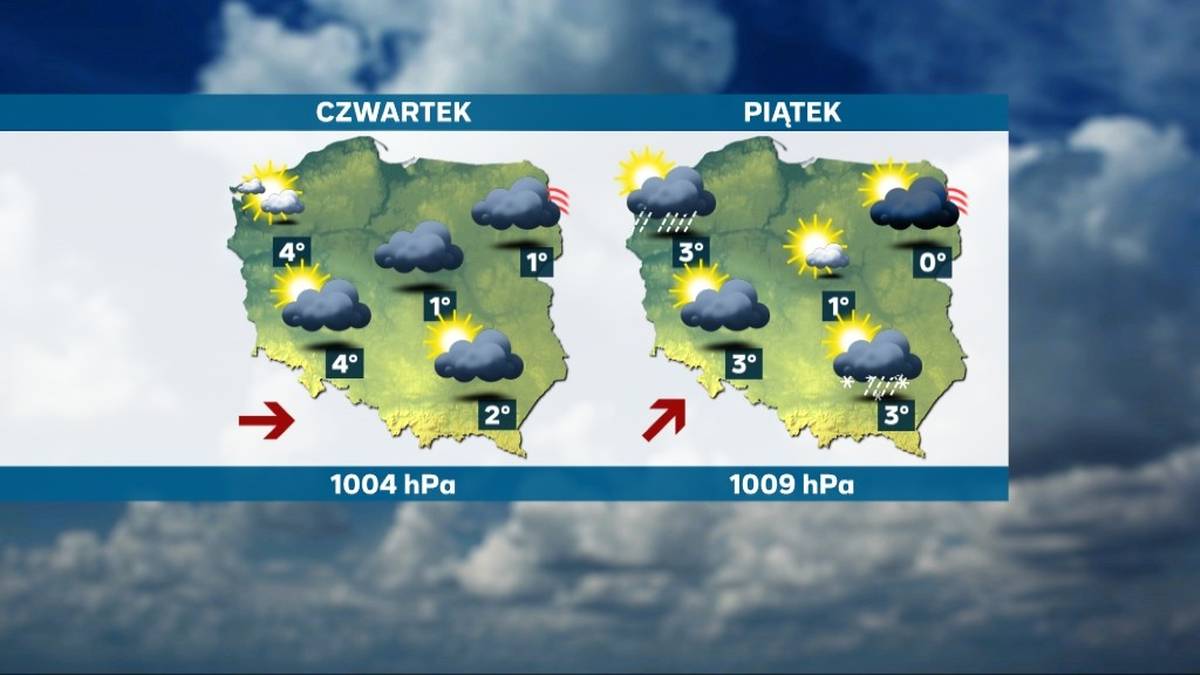
Winter Weather Impacts Poland; No Respite Expected Soon
The winter storm will affect much of the country throughout the day, though temperatures will remain relatively mild in some areas. The warmest temperatures, reaching up to 48 degrees Fahrenheit, are expected in the southeastern regions. Elsewhere, temperatures will range from 30 to 34 degrees Fahrenheit, according to the IMGW.
SEE: Major blizzard headed straight for Poland: Here’s where and when it will hit
The weather is not expected to improve quickly. Thursday will also bring widespread cloud cover, with clearer skies only in the northwest. Scattered rain and snow showers are possible, though not as intense as Wednesday.
Conditions should improve on Friday, with more sunshine expected, although isolated showers are still possible.
 Albedo-Polsat News
The more stable weather pattern will also bring colder nighttime temperatures. Temperatures could drop to as low as 17 to 21 degrees Fahrenheit, particularly in the northeast. Daytime temperatures will remain near or slightly above freezing.
Did you see something important? Send a photo, video, or tell us what happened. Use our Viewer Platform