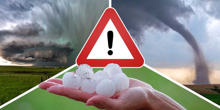
Germany faces severe thunderstorms, hail, and strong winds on Friday, May 29, 2026, with regions from the northwest to the east under heightened weather warnings. The German Weather Service (DWD) has issued alerts for heavy rainfall, gusts up to 110 km/h, and hailstones measuring 2–4 cm in diameter, affecting cities like Bremen, Hannover, Dortmund, and Düsseldorf. The storm system, driven by a clash of warm and moist air masses, is expected to intensify through the weekend, disrupting outdoor events and prompting local authorities to advise caution.
Severe Weather Alert Issued for Western and Northern Germany
cluster (priority): T-Online
The DWD has classified the weather event as the “first significant thunderstorm series of the year,” with particularly intense conditions expected in the western and northern parts of the country. “The weather system is fundamentally changing,” said meteorologist Markus Übel, noting that low-pressure systems are displacing the previous high-pressure stability. Heavy thunderstorms, featuring wind gusts of up to 110 km/h, hail, and rainfall of up to 30 liters per square meter, are anticipated from Friday afternoon through the evening, with some regions facing localized flooding and fallen trees.
The affected areas include cities such as Bremen, Hannover, Dortmund, and Düsseldorf, as well as the broader regions of Lower Saxony, North Rhine-Westphalia (NRW), and parts of Hessen. “Regional differences are significant,” the DWD emphasized, with the strongest storms expected in the Emsland, southern Lower Saxony, and western parts of North Rhine-Westphalia. The warnings are in effect until midnight on May 30, 2026, though some areas may experience lingering effects into the following days.
Impact on Local Communities and Events
cluster (priority): WDR
Outdoor events across NRW, including the “Wein am Rhein” festival in Düsseldorf and the Dürpelfest in Solingen, have been placed under close monitoring. Organizers have prepared for rain with shelters and umbrellas, but officials warn that severe thunderstorms could force cancellations or disruptions. “If storms or lightning develop, the event may need to be suspended,” a spokesperson for “Wein am Rhein” told the WDR. Similar concerns apply to other large gatherings, such as the Tolkien-Tage in Geldern and the GEspaña Flamenco-Festival in Gelsenkirchen.
The DWD also highlighted risks for swimmers and hikers, as lightning strikes and falling branches could pose immediate dangers. “Stay indoors during thunderstorms and avoid open fields,” the agency advised. Local authorities have urged residents to secure loose objects and avoid driving through flooded areas, which could lead to vehicle entrapment.
Meteorological Analysis of the Storm System
Brazil Storm Chaos! 110 km/h Winds Flip Truck, Giant Hail Batters Towns Across Rio Grande do Sul
The storm’s intensity stems from a combination of factors, including a shift in wind patterns and the collision of air masses. According to meteorologist Dominik Jung, a “strong jet stream at around nine kilometers altitude” is creating wind shear, transforming ordinary thunderstorms into long-lived, rotating cells. “These are the most organized and dangerous storm forms,” Jung explained, warning that supercells capable of producing tornadoes cannot be ruled out.
The DWD describes the system as a “rotating storm complex” that will move eastward through the weekend. On Saturday, the focus shifts to central Germany, with heavy showers and thunderstorms expected in regions like the Ruhrgebiet, Harz, and Bavaria. Sunday will bring another round of instability, with the potential for localized flooding and continued strong winds. “The weather remains highly variable,” the DWD noted, stressing that forecasts may need adjustments as the system evolves.
Regional Variations in Weather Patterns
While western and northern Germany face the brunt of the storms, southern and northern regions will experience milder conditions. In the north, temperatures are expected to range between 19–25°C, with more sunshine, while the south may see 22–25°C but with scattered showers. The DWD emphasized that “precipitation patterns are still uncertain,” with some areas potentially escaping the worst impacts.
However, the threat of flash floods remains a concern, particularly in low-lying areas and near rivers. The agency has warned that “localized flooding and basement inundation are possible,” urging residents to monitor water levels and avoid areas prone to runoff.
What Comes Next? Forecast for the Weekend
By Saturday, the storm system is expected to weaken slightly, though heavy rain and thunderstorms will persist in central Germany. The DWD predicts that “the critical axis of the weather system will shift eastward,” affecting regions from the Rhine-Ruhr area to the Bavarian foothills. Sunday will bring a mix of rain and isolated thunderstorms, with temperatures remaining in the 22–25°C range.
Despite the forecasted slowdown, meteorologists caution that “the weather remains unpredictable.” The DWD has advised residents to stay informed through local alerts and to avoid unnecessary travel during peak storm periods. As the first major weather event of the year, the situation underscores the importance of preparedness in an era of increasing climate volatility.
ail: emily.johnson@headlinez.news
Bio:
Emily Johnson serves as News Editor at Headlinez.News, overseeing the publication’s coverage of national and breaking stories. She has worked in journalism for more than 12 years, building a reputation for precision, credibility, and rapid-response reporting. Emily’s editorial philosophy focuses on clear, fact-based writing that helps readers understand the full context behind the day’s most important events. Her expertise bridges traditional reporting and modern digital news strategies.
Expertise: Breaking news, political reporting, fact-checking, newsroom coordination, public affairs.
Location: Washington, D.C., USA